
Fusagasugá
Department
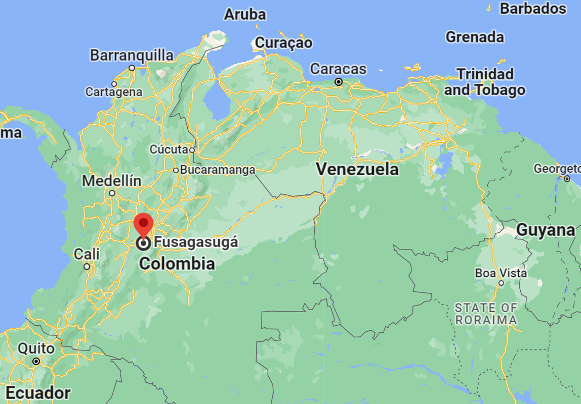
Cundinamarca, Colombia

Flag of the city

Seal of the city

Slogan of the city
The city of Fusagasugá, located in Colombia, proudly carries the slogan “Tierra Grata.” This phrase, when translated to English, means “Pleasing Earth.” It’s a fitting descriptor, reflecting the city’s rich natural beauty and its residents’ connection to the land. Such slogans often encapsulate the spirit and essence of a place, hinting at its cultural, historical, or natural significance. In the case of Fusagasugá, “Tierra Grata” suggests a warm, welcoming environment, promising both residents and visitors a sense of belonging and appreciation. It’s a testament to the city’s commitment to preserving its natural charm while welcoming growth and development.
History
Prior to Odor Bernardino Albornoz’s establishment of the new town 5-13 February 1592, the locals were the Sutagao people. Previous native inhabitants are largely unknown. Odor Ibarra found 759 natives living in Fusagasugá at the time. The indigenous population was at its lowest point of 85 people when Odor Aróstequi came in February 1760, and there were 109 households totaling 644 new settlers. A tiny hospital was opened close to the church on February 19, 1760, and Father Vicente de Fresneda was put in charge of it.
Due to the decline in indigenous population and the increase in local settler population, two officials, Moreno and Escandón, declared on January 8, 1776 that the native villages of Pandi and Tibacuy in the Fusagasugá area no longer existed and merged them into the modern city of Pasca. All city streets and plazas were renamed as a result of this decision.
In 1771, the viceroy Messia de la Zerda followed the advice of the mayor of Fusagasugá and had a new avenue named Santafé built that would lead from Fusagasugá to Sibaté. On August 8, 1774, Father Francisco Escobar claimed that Fusagasugá was on the path that went over the mountains and led to the nearby towns of Apicalá and Melgar; and that there was no other way to get to Bermajal, which was also located on the same mountain. The suburb’s status as a regional hub was thus confirmed.
The road from Fusagasugá to the southern provinces was officially recognized by the president of the Colombian republic in an order given on August 7, 1846, prompting the construction of a bridge over the Sumapaz River in Boquerón. Fusagasugá was annexed to Tequendama in 1852.
On February 9, 1877, government soldiers led by General Mogollón fought rebels led by Colonel Juan Ardila and Lucas Moreno at the hacienda El Novillero. Don Manuel Mara Aya Caicedo and Lady Sagrado Cleofé Diaz funded the original hospital’s construction by the Congregation of the Sacred Heart of Jesus in 1893. They also established the adjacent nursing facility. National Directive 489 was published on November 7, 1895, and Law 162 was passed in 1896, creating the province of Sumapaz. Fusagasugá was designated as the province capital.
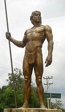
At the entrance to Fusagasugá is where you’ll find this statue of a Sutagao guy.
A road connecting Sibaté, Fusagasugá, and Boquerón was contracted on February 22, 1893, by Dr. José Manuel Goenaga, minister of works under President Miguel Antonio Caro. Enrique Pabón Liévano, a local of Fusagasugá, was the project’s engineer. Initiated in 1905 during the presidency of Rafael Reyes, the project was halted on February 10, 1906 after an attack by the Barro Colorado. In March of 1913, it picked back up again. By 1930, Fusagasugá and Arbeláez had both gained access to the highway.
Boquerón’s iron-and-wood bridge across the Sumapaz River was named “Puente Eliseo Medina” in honor of the then-current administration. This bridge was completed in 1907. The first autos crossed the bridge in 1930; the current bridge was built in its place in 1953.
The road between Fusagasugá and Boquerón along the Llano River was first envisioned in article 12 of ordinance 21 passed that year (1944).
The first cemetery, located at the old “Pekin” location, was dedicated that same year (1822). In 1852, a second one, situated in front of the medical center, took its place. On October 31st, 1910, the Cura Sabogal established a third burial ground.
The candidacy of Enrique Olaya Herrera was declared in the Quinta Coburgo in 1929. Institute Universitario Técnico (Technical University Institute) was founded in 1970. On December 19, 1969, Governor Joaqun Pieros Corpas signed ordinance 45, which founded the bank. On May 8, 1970, Pieros Corpas issued directive 537, formalizing the bank’s existence.
The city’s major church has been reconstructed several times. In June of 1658, Father Andrés Méndez de Valdivieso constructed the original church. Father Poveda constructed the second church in 1707, and it remained in use until 1865. Soon after, Father Antonio Martinez erected a third church. Despite being constructed of bricks, it was destroyed on September 19, 1908. On June 6, 1909, construction began on what would become the fourth church on that site; it was dedicated eight months later, on August 15, 1926. Ismael Perdomo, the Archbishop of the area, blessed it. The Nuestra Seora de Belén (English: Our Lady of Bethlehem) was dedicated on August 16, 1786, however the city has a long history of churches.
A hotel in the city served as an internment camp for people from nations in the Axis Powers during World War II.
Geography of the city
The city’s elevation ranges from 550 m to 3,050 m, with a mean altitude of 1,728 m (5,669 ft). It enjoys an average temperature of 19°C (66°F).
The municipality’s humidity averages at 85%, peaking at 93% and dropping to a low of 74% within different subzones. Wind speeds typically average 1.0 m/s at 7:00 am, peak at 2.7 m/s by 1:00 pm, and settle to 1.1 m/s by 7:00 pm. The wind can reach up to 10.4 m/s in a month and can be completely still (0 m/s) by evening.
Annually, the municipality receives more than 1,250 mm of rainfall. The wettest months include March, April, May, October, November, and December, while the drier periods span January to September. Across five stations, the total rainfall recorded is 1389.4 mm. The area’s aridity index of 47.79 classifies it as Semi-arid. The region basks in about 1560 hours of sunlight yearly, averaging 130 hours monthly, with an annual evaporation rate of 1105.9 mm.
Location coordinates are 4°20′42.55″N 74°21′42.56″W.
Population
156 928 (2023)
138,498 (2018)
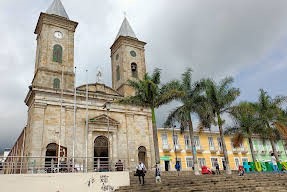
One photo representative of the city
In the picturesque city of Fusagasugá, nestled amidst Colombia’s verdant landscapes, the Plaza Principal stands as an emblematic beacon of the city’s cultural, historical, and social tapestry. For both locals and tourists, this central square encapsulates the very essence of Fusagasugá, rendering it as the most representative spot in the city.
Walking into the Plaza Principal is akin to stepping into a lively tableau of daily Colombian life. On any given day, the square is a cacophony of sounds and sights: vendors peddling local delicacies, children chasing pigeons, elderly gentlemen deep in conversation under the shade of trees, and occasionally, the harmonious strains of a street musician’s guitar filling the air. The plaza is more than just a place; it’s an experience, a living testament to the city’s vibrant community spirit.
Architecturally, the Plaza Principal pays homage to Fusagasugá’s rich history. The stately buildings lining the square, many of them bearing the hallmark of colonial-era design, whisper tales of yesteryears. Dominating the scene is the town’s main church, its spire reaching skyward, standing as both a religious landmark and a beacon of the community’s shared heritage.
But beyond its aesthetic appeal and daily bustle, the Plaza Principal holds deeper significance. It serves as the city’s communal gathering spot, where festivals are celebrated, announcements are made, and communal bonds are strengthened. The square has, over the years, witnessed countless stories – from lovers’ first meetings to spirited political debates.
In essence, the Plaza Principal is more than just a physical space; it’s the heartbeat of Fusagasugá. It represents the intertwining of the past with the present, the fusion of tradition with the everyday, and above all, the unyielding spirit othe people of Fusagasugá.
Etymology
Fusagasugá (Spanish pronunciation: [fusaɣasuˈɣa]; from Cariban fusagasuga ‘woman who becomes invisible’) or Fusa is a city and municipality in the department of Cundinamarca, in central Colombia.
What the city is known or famous for
Fusagasugá, often affectionately termed “Tierra Grata,” draws its name from the sprawling farms, or “Quintas,” that dot its verdant landscape. These quintas, many of which have stood for generations, not only add to the region’s rich agricultural heritage but also epitomize the symbiotic relationship between the land and its inhabitants. This intricate tapestry of farmsteads contributes significantly to the city’s reputation, making it a testament to Colombia’s agricultural prowess.
Furthermore, Fusagasugá proudly bears the moniker “La Ciudad Jardín de Colombia,” which translates to “The Garden City of Colombia.” This title isn’t merely a decorative epithet; it’s a nod to the city’s extensive production of orchids. These exotic blooms, with their diverse shapes and vibrant hues, thrive in the region’s amenable climate. As one wanders through the city and its outskirts, the sight of orchids, cultivated with care and passion, serves as a constant reminder of Fusagasugá’s botanical significance. This emphasis on orchid cultivation has not only boosted the city’s economy but has also positioned it as a hub for horticultural enthusiasts and experts from across the globe.