Envigado
Department
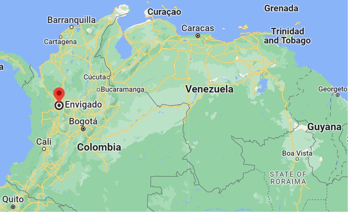
Antioquia, Colombia

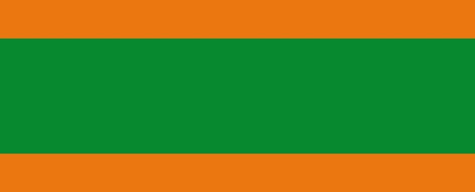
Flag of the city
Flag of the municipality of Envigado (Antioquia). “By Agreement No. 001 dated November 19, 1982, the Envigado Council adopted the Municipal Flag, adhering to the standards set forth in our Constitution. According to the terms of this mandate, green was chosen as a symbol of the Antioquian identity that has always defined the people of Envigado. This green is complemented by orange, representing the vigor, dynamism, and forward-looking vision of consistent development and progress in the city. The flag features three horizontal stripes: orange, green, and orange, with the green stripe in the middle being twice the size of each orange stripe.” Colors used.

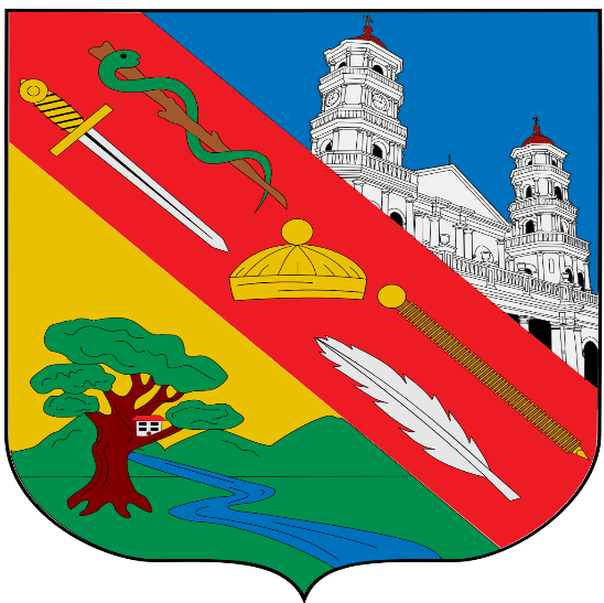
Seal of the city

Slogan of the city
Envigado, a city situated in Colombia, is celebrated for upholding the rich traditions of the Paisa Region, evident in its distinctive architecture. Boasting one of the country’s highest living standards, it stands out as a beacon of prosperity and well-being. Notably, according to the renowned Colombian magazine Semana, Envigado known as the nation’s lowest number of individuals experiencing “unmet basic needs”, further underscoring the city’s commitment to the welfare of its residents.
History

Archaeological research within the La Morena ecological reserve has unearthed evidence of pre-Hispanic settlements dating back over 10,000 years. These ancient inhabitants were predominantly hunter-gatherers, thriving off the river and forest resources of the Medellín-Porce river basin for nearly 6,000 years. They were early cultivators, relying both on wild and domesticated plants. Their history provides a glimpse into the onset and progression of agriculture in northern South America. Later on, more advanced societies emerged in the region, displaying advanced agriculture, settled village life, and intricate pottery and burial customs.
Envigado’s early days saw it populated by the Nutabe tribe, with significant settlements in the Palenque area. However, by 1541, the Spanish, led by Jerónimo Luis Tejelo under Jorge Robledo’s command, began colonizing the region. Captain Álvaro de Mendoza, another of Robledo’s men, described the valley as breathtaking, with a native town to the south, which we now recognize as Sabaneta and Caldas. While these early Spanish expeditions primarily sought the legendary city of gold, El Dorado, their first foray into the Aburrá valley was within Envigado’s boundaries.
In 1547, Gaspar de Rodas, the province’s last governor, sought a land grant in the valley near present-day Envigado. By the time the Pedroso faction arrived in the valley four years later, it was predominantly inhabited by indigenous tribes. It wasn’t until settlers from the Villa de La Candelaria in Medellín turned their attention to this area that the name “Envigado” came to be.
By the 1630s, several towns dotted the valley landscape, with Envigado’s first chapel constructed in 1750. The town’s formal establishment came in 1775 with the creation of the Parish of Santa Gertrudis. From its inception, Envigado’s fate was intertwined with Medellín’s, although it always retained a distinct identity. Over time, large estates formed the backbone of the region, occupied by wealthy landowners who often intermarried with less affluent Spanish settlers.
Official documents from 1743 onwards referenced Envigado. The region’s etymology might be linked to its provision of wood, particularly “long perfect trunks” or beams. The late 18th century marked urban development in Envigado with the establishment of the Santa Gertrudis Parish and the demarcation of the first streets. By 1814, under Juan Del Corral’s rule, it attained municipal status.
The 20th century heralded modernization for Envigado with infrastructure projects like aqueducts and the Manuel Uribe Ángel Hospital. The town also experienced the painful legacy of drug trade, most notably linked to the infamous Pablo Escobar. In 2016, following a public consultation, Envigado joined the Aburrá Valley Metropolitan Area, aligning with nine other regional municipalities.
Geography of the city
Envigado, situated at 6°10′19″N 75°35′09″W, lies to the south of the Aburrá Valley within the Colombian Andes’ Central mountain range. This city stands distinctively on an elevated plane relative to the rest of the valley.
The city is approximately 10 kilometers away from central Medellín and about 545 km from the nation’s capital. The central area of Envigado is at an altitude of 1,575 meters above sea level. The highest points within the municipality reach 2,900 meters above sea level at Cerro Astilleros and 2,500 meters at Alto Patio Bonito.
Historically, Envigado grew around the La Ayurá stream basin, which, up until the 1940s, sufficiently supplied the local water needs.
The city has become an integral part of the expanding urbanization of the Aburrá Valley. Covering an estimated area of 78.80 km², 66.68 km² is rural, while 12.12 km² is urbanized. Out of the total 1,152 km² area of the Aburrá Valley, Envigado claims 4.3 percent, ranking seventh in size among the ten municipalities in the valley. It is bordered by Medellín to the north, Sabaneta, Caldas, and El Retiro to the south, Rionegro and El Retiro to the east, and Itagüí to the west.
Climate-wise, temperatures in Envigado range from an average of 21°C in the city center to 16°C in higher altitudes, accompanied by an average relative humidity of 70 percent. The Aburrá Valley and eastern Antioquia exhibit a pattern of two wet and two dry seasons each year. The climate ranges from humid to very humid, with an average annual rainfall of 2,000 millimeters, fluctuating from 1,200 millimeters in the northwest to 2,300 millimeters in the eastern highlands.

Population
228,848(2018)
267 285(2023)
One photo representative of the city
A quintessential representation of Envigado in terms of cultural relevance and allure is the “El Parque de Envigado” or the Main Square of Envigado. This park stands as the city’s pulsating center, drawing both locals and tourists to its midst.
Framed by classic Antioquian structures, the standout feature of the square is the majestic Church of Santa Gertrudis. Trees dot the park, providing shade, while benches offer spots for relaxation and leisurely observation. The park’s vibrancy amplifies during weekends and festive days, complete with stalls, entertainers, and impromptu dance acts.

Etymology
The name “Envigado” is believed to be derived from the Spanish word “viga,” which translates to “beam” or “rafter.” This etymology reflects historical anecdotes suggesting that the area was known for its large trees, which were used to produce beams or rafters for constructing houses. Over time, “Envigado” came to identify the region, possibly because of its association with the production or supply of these beams to surrounding regions.
What the city is known or famous for
Envigado, historically recognized as a commercial and manufacturing hub for the rich agricultural and pastoral regions surrounding it, has witnessed significant transformations over time. Once primarily driven by the agricultural bounty of its vicinity, it evolved to become an integral part of the extensive industrial conglomerate anchored by Medellín, the capital of the Antioquia department, situated just 6 miles (10 km) to the north. A notable shift in Envigado’s economic landscape is its pronounced focus on textile manufacturing, which has emerged as the city’s primary industry. This transition highlights the dynamism of the region and its ability to adapt and integrate into the larger economic framework of the Medellín metropolitan area.
