Bello
Department
Antioquia, Colombia

Flag of the city
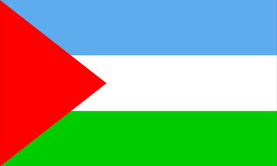
The Bello, Colombia flag boasts three horizontal bands. The uppermost band is a vivid blue, representing the sky or other local elements. Centrally, a white stripe, often linked with notions of unity, purity, or peace. The flag concludes with a green stripe at its base, evoking images of the city’s verdant landscapes and nature. A standout feature of the flag is a red triangle on its right side, which embody concepts progress, direction, and transformation.
Seal of the city
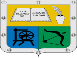
Slogan of the city
Bello, Colombia, proudly bears several titles that encapsulate its rich history and cultural significance. Known as the “Marco Fidel Suárez’s Cradle, Bello commemorates its ties to this notable Colombian figure, who once held the esteemed position of the nation’s president. The epithet “Artist’s City” suggests Bello’s vibrant artistic pulse, underscoring both its historical heritage and the ongoing contributions of its contemporary artists. Delving deeper into its roots, “Cacique Niquia’s Empire” evokes the city’s indigenous past, with Cacique Niquia being a pivotal indigenous leader in the region’s history. Echoing its forward-thinking ethos, Bello adopts the slogan “City of progress,” highlighting its commitment to continuous growth and development in various facets of urban life.
History
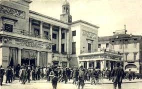
The city of Bello, which translates to “Beautiful” in English, traces its origins back to 1676 when it was founded as “Hato Viejo.” It was later renamed in tribute to Andrés Bello and achieved city status in 1913. Widely recognized as the “City of Artists” within Colombia, its leadership is currently under Mayor Carlos Alirio Muñoz López.
In July 1541, Jerónimo Luis Tejelo, Jorge Robledo’s Deputy Marshal, discovered the vast Los Aburrá valley inhabited by indigenous communities, notably around the area now named Bello, then known as Niquías. The locals lived in distinctive clustered housing patterns. By 1574, a Spaniard named Gaspar de Rodas sought to secure the Aburrá Valley to cultivate crops and rear livestock to support the ongoing conquest. The Spaniard’s request was granted, covering regions stretching from what is now central Medellin to Niquía. By 1576, Rodas began exerting Spanish influence over the region, and from 1613, the locale was referred to as Hatoviejo, distinguishing it from subsequent herds.
Historically, the colonizers built chapels on their farms as symbols of nobility and prestige. Hatoviejo did not exhibit the traditional foundational structure with organized squares and streets. It instead witnessed the construction of multiple chapels including Our Lady of Chiquinquirá (1653), Our Lady of the Rosary (1720), Our Lady of Sopetrán (1775), and Our Lady of Guadalupe (1761). Many of these religious edifices underwent relocation or demolition. Notably, the Hatoviejo Parish Church of Our Lady of the Rosary was torn down in 1788, making way for the Hatoviejo Chapel in 1792, which persists today. By 1788, Hatoviejo was elevated to the rank of “party”, falling under the jurisdiction of Nuestra Señora de la Candelaria in Medellin.
The urban layout of Hatoviejo was influenced by its residents’ economic functions. Central to the settlement was the Church of the Rosary square, with references often made to the upper and lower roads, or “Calle arriba” and “Calle Abajo.” On December 28, 1883, the village was renamed from Hatoviejo to Bello. This change was spurred by locals who felt the term “Hato” was derogatory, likening them to animals. They believed “Bello”, alluding to the esteemed Andrés Bello, projected a more refined and dignified image.
Geography of the city
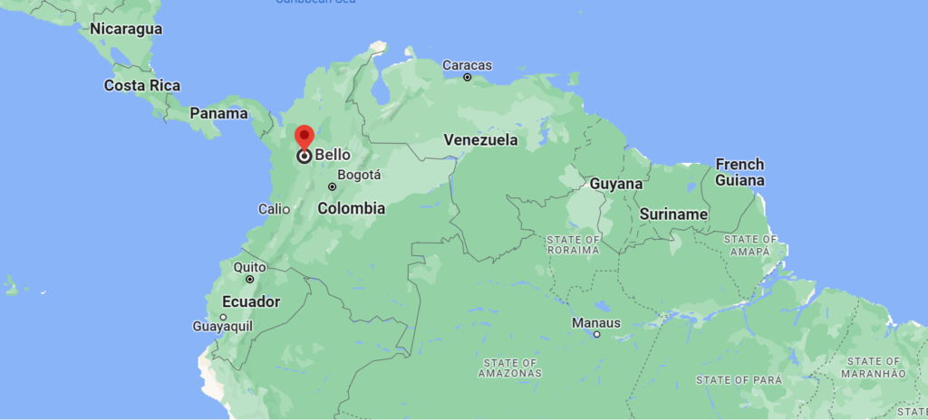
Bello is nestled within the Aburrá Valley, a picturesque setting within the Andes Mountains. Adjacent to Medellín to the north, this city enjoys a warm climate moderated by consistent breezes all year long.
Spanning a total of 142.36 km², Bello’s landscape comprises 19.7 km² of urban terrain and 122.66 km² of rural expanses. While the plains of the valley are densely urbanized, its slopes are bustling with activity. The Medellín River meanders through the valley from the south to the north, accompanied by 57 tributaries over its 70-kilometer course.
Bello boasts geographical coordinates of approximately 6.3373° N in latitude and 75.5579° W in longitude. Owing to its varied topography, the altitude of Bello fluctuates, but the city typically rests at an elevation ranging between 1,400 to 1,600 meters above sea level.
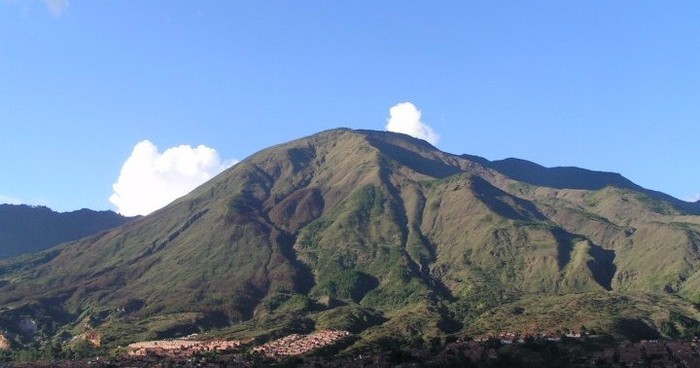
From a topographical standpoint, Bello’s urban region gently slopes from altitudes of 1600 to 1400 meters above sea level. Located in the valley’s northern section, the city is encompassed by mountains soaring over 2,500 meters. One of its most prominent geographical landmarks is Cerro Quitasol. Towering at 2,880 meters above sea level, this pyramidal mountain stands to the city’s north, revered as Bello’s guardian hill.
Situated in the tropical zone, Bello doesn’t undergo significant climate variations. On average, the city receives 1347 mm of rainfall annually. Its temperature, influenced by different climatic zones, ranges from desertic to cold, with the majority of the region experiencing an average temperature of 25.7°C. This temperature is relatively consistent year-round, with alternating dry and wet spells. The city’s climate is further tempered by winds coursing through the valley year-round.
Trade winds from the nearby Cauca and Magdalena river valleys converge here, forming a warm air blanket. This increases humidity and barometric temperatures in the city’s lower regions and certain neighboring areas. Due to these wind patterns, northern towns like Bello, Copacabana, Girardota, and Barbosa tend to be warmer than the capital city of Antioquia, Medellín, even though they are closely situated.
Population
528,810(2023)
Population of approximately 473,400 in the year 2017, which constituted about 0.965% of Colombia’s total population. Given the observed population growth rate from 2015-2017, which was +1.91% annually, a projection can be made for the year 2023. Using this rate, the estimated population for Bello in 2023 would be approximately 528,810.
One photo representative of the city
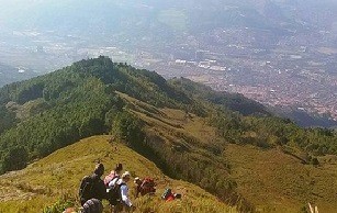
Quitasol is a prominent natural hill in the Aburrá Valley, situated in Bello, just north of Medellín, in the Antioquia department of Colombia. Its majestic presence has made it a centerpiece of local celebrations, leading it to be the namesake for the “Fiestas del Cerro Quitasol” of the municipality.
Bello, a key municipality within the Medellín metropolitan region, is home to the towering Cerro Quitasol, one of the Aburrá Valley’s significant landmarks. This hill encompasses a waterfall teeming with a diverse aquatic ecosystem.
Locally, Quitasol is familiarly referred to by the residents of Bello as a place where age-old indigenous trails from the Cacique Niquía community still exist. These trails on the hill’s slopes reveal remnants of an ancient society, showcasing their engineering prowess. One such pathway, called the stone path of the aburráes of Niquía, is believed to have historical significance from pre-colonial times, meandering through forests and showcasing a rich biodiversity of plants and wildlife.
Regrettably, in recent times, Cerro Quitasol has faced threats from human actions, particularly forest fires aimed at clearing land for urban expansion in Bello. One of the most devastating of these incidents occurred on February 8, 2017, when a massive blaze consumed over 110 hectares over three days. This fire was eventually contained with the assistance of national helicopter units.
Etymology
“Bello” is a surname prevalent in both Italian and Spanish cultures, originating from the term “bello” which means “handsome” or “beautiful” in English, stemming from the Late Latin word “bellus”. Translating to “Beautiful” in English, Bello initially started as “Hato Viejo” in 1676. It later changed its name in tribute to Andrés Bello and was designated as a city in 1913. It’s often referred to as the “City of Artists” within Colombia, with Carlos Alirio Muñoz López currently serving as its mayor.Back in July 1541, a troop led by Jerónimo Luis Tejelo, who was the Deputy Marshal to Jorge Robledo, discovered the expansive Los Aburrá valley. This area was inhabited by native farmers living in loosely structured communities with dispersed housing. The settlement of Niquías, which has since become part of Bello, was a prime example of such living arrangements.
What the city is known or famous for
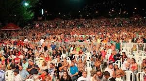
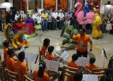
The Fiestas del Cerro Quitasol stand as a paramount cultural event in Bello, Colombia, symbolizing the city’s deep reverence for the Cerro Quitasol hill, a dominant natural figure in the Aburrá Valley. Beyond merely celebrating the hill’s scenic beauty, the festival is a vibrant tapestry of Bello’s history, traditions, and heritage. Throughout the event, the city pulsates with a plethora of activities, from traditional dance and music performances to art exhibitions, all interwoven with the spirited parades of the Bellanitas. One of the most anticipated events is the trek to the hill’s summit, a journey offering breathtaking panoramic vistas of Bello and its surroundings. This ascent, however, is not solely for the view—it’s a reflective pilgrimage, symbolizing Bello’s intrinsic connection to the hill and its past. The festival also serves as a platform to honor Bello’s indigenous roots, particularly the paths linked to the Cacique Niquía community. Yet, the Fiestas del Cerro Quitasol are more than a celebration of history and nature. Recent editions have underscored the urgent need for environmental conservation, especially considering the challenges Cerro Quitasol faces from forest fires and urban expansion. In essence, this festival captures Bello’s heart, narrating its tales of culture, history, and an undying commitment to the environment.
