AGUACHICA
Department



Slogan of the city
Aguachica can be seen as a city of “Harmony in Heritage”. This slogan encapsulates Aguachica’s rich history and cultural heritage. Geographically, the city’s positioning between the Cordillera Oriental and the Magdalena River symbolizes a harmonious blend of mountainous terrain and flowing rivers, echoed in the emphasis on “Harmony in Heritage.”
History
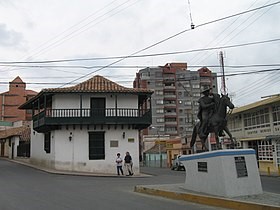
Aguachica’s history unfolds across distinct eras, beginning with pre-Columbian times when the Chimila tribes inhabited the region, only to face brutal decimation upon the arrival of Spanish conquerors. In the early 17th century, the Spanish established the Hacienda de San Roque, evolving into a settlement owned by Don Casimiro Ramos de Barahona. By 1748, under the royal grant to Jose Lazaro de Rivera, the settlement became a Roman Catholic parish, aligning with Jose Fernando de Mier y Guerra’s mission to pacify the Chimila. The village, relocated in 1804 due to a devastating plague, was integrated into the Government of Santa Marta in 1753.
In the Republic era, Aguachica witnessed migrations driven by coffee plantations and later, petroleum discoveries in the 1920s. The strategic importance of Aguachica burgeoned with the construction of highways and the Magdalena railroad in the 1950s, transforming it into a pivotal junction between the Andean and Caribbean regions. The 1960s marked agricultural expansion, attracting settlers from Tolima, fostering economic growth in agriculture, commerce, and services.
However, the late 20th century brought challenges as the Colombian armed conflict, particularly during the 1980s and early 1990s, influenced the region. This period saw significant population displacement, with people seeking refuge in the municipality seat from the conflict-affected rural areas and neighboring regions in the Department of Bolívar and the Department of Cesar. There is no historical support on the date of its foundation; however, August 16, 1748 has been chosen by the community
Geography of the city
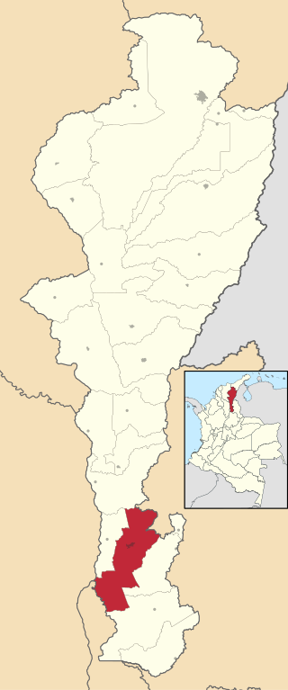
Aguachica is situated in the southern reaches of the Cesar Department, flanked by the majestic Cordillera Oriental Andean mountains to the west and the flowing waters of the Magdalena River to the east. The municipality shares its borders with La Gloria and the Department of North Santander to the north, Rio de Oro to the east, and San Martín and the Department of Santander to the south. To the west, Aguachica is bordered by Gamarra and the Department of Bolívar. Encompassing a total area of 876 km², Aguachica constitutes 3.8% of the entire landmass of the Department of Cesar. The northern expanse of the municipality is characterized by mountainous terrain within the Cordillera Oriental, boasting elevations ranging from 200 meters to 2,150 meters above sea level. In contrast, the southern region is predominantly flat, crisscrossed by the meandering waters of two significant rivers—the Magdalena River and the Lebrija River. This diverse geography contributes to Aguachica’s scenic beauty and underscores the municipality’s position as a dynamic intersection between mountainous landscapes and fertile plains.
Population
Municipality and city – 118,652 (2020)
Urban – 103,209 (2020)
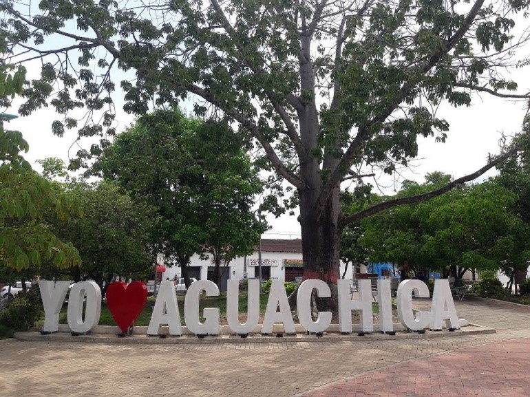
One photo representative of the city
Etymology
The name “Aguachica” is believed to have indigenous roots, reflecting the linguistic and cultural heritage of the region. It is often suggested that the name is derived from the indigenous Chimila language spoken by the native tribes who inhabited the area before the arrival of the Spanish. Given the historical context, it is likely that “Aguachica” holds significance related to the geography, nature, or cultural practices of the indigenous people. For instance, Aguachica has religious sites such as Cerro de la Cruz (lit. ’The Cross Hill’) in which religious traditions are practiced and where the pilgrimage of parishioners from the municipality begins, in addition to the San Roque Parish, this building, built in the hacienda of the same name, is considered the starting point of the establishment of the church and history of Aguachica
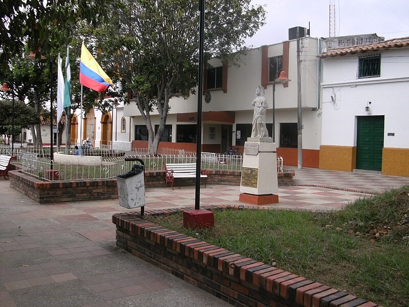
Aguachica is renowned for its rich religious heritage and historic landmarks. The iconic Cerro de la Cruz, or ‘The Cross Hill,’ serves as a sacred site where religious traditions are practiced, marking the starting point for the pilgrimage of parishioners from the municipality. The San Roque Parish, rooted in the hacienda of the same name, holds historical significance, considered the starting point for the establishment of the church and the city’s history. Documented in the book “Floresta de la Santa Iglesia Catedral de la Ciudad y Provincia de Santa Marta,” the San Roque Parish has a history dating back to the 18th century when, by 1748, Aguachica was officially assigned as a parish. Aguachica’s religious tapestry extends to the Church of Maria Auxiliadora, established by the Comboni Missionaries. This spiritual haven, completed in 2006, stands as a testament to the community’s faith and cultural diversity. Adding to the city’s allure is the Eladio Vargas Cultural Center, a heritage site safeguarding Aguachica’s history, traditions, culture, and folklore for over 18 years. In harmony with its cultural treasures, Aguachica boasts the natural splendor of the Agüil Forest, a nature reserve teeming with biodiversity. Hosting 40 species of butterflies, 88 types of birds, and a diverse array of flora, including Acalypha, Machaerium, and Solanum, the forest spans 8 hectares. Aguachica’s commitment to preserving both its cultural and natural heritage makes it a unique destination where spirituality and nature converge in a harmonious blend.
